NOTE: The feature surface can be edited in Pop-In or Pop-Out mode. For an explanation of these modes see Editing Modes.
The feature surface is defined by a collection of elevation features; either drawn manually on screen or loaded from a file. Any combination of the following terrain features can be used to define the terrain:
|
|
Outlines This element is used to define the outline(s) of the feature surface. There will almost always be only one outline, but it is possible to define more than one to create several 'islands' of terrain. It is also possible to create holes in the terrain by adding internal outlines. There are also different types of Outline:
|
|
|
Contour Lines Contour lines (or isolines) are used to define lines on the terrain with a fixed elevation |
|
|
Break Lines Break lines are used to defined lines on the terrain which have a varying elevation |
|
|
Point Levels Point levels are used to define the levels for individual points in the terrain area |
The properties of each feature vary depending on the feature type, but they all have a 'Tag' which can optionally be set. This is an identifier for the feature (akin to the feature's name), and it is used to help the user identify particular features.

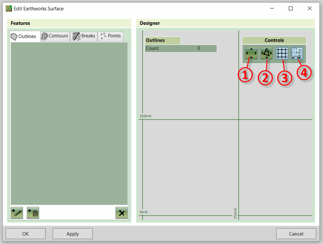
This form includes three display buttons as described below:
- ① Zoom to Extents This button zooms to designer to extents (i.e. frames all elements in the designer panel)
- ② Zoom to Selection This button zooms to designer to selected features
- ③ Toggle Grid This button toggles the grid in the designer on and off.
- ④ Toggle Site Plan This button toggles the site plan in the designer on and off.
The rest of the controls on this form are used to add, remove and edit the terrain features. They are described in detail in the following sections.
|
Video Guides The following video tutorials relate to this topic : [1] Proposed Earthworks : The Surface Element : A video which demonstrates how to easily produce estimates for any proposed earthworks defined by survey points, contour lines and break lines. [2] Understanding Feature Surface Outlines : In this video we look in detail at the outlines of the feature surface. |