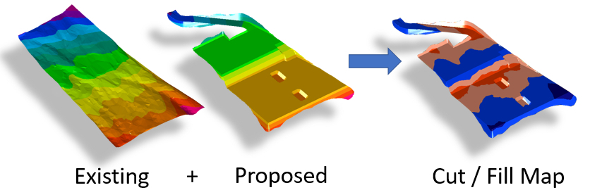
Existing ground can be defined using points, contour lines, break lines and outlines. You can draw elevation features manually over a plan or import directly from CAD, LandXML, excel or text file formats. From the elevation features an existing surface is created using a Delaunay triangulation algorithm.
In a similar manner a variety of earthworks elements can be used to define proposed terrain. Simple works like building foundations can be defined with platform and slope elements. For more complex take-off jobs a proposed surface of points, break lines, contour lines and outlines can be used. After defining proposed earthworks, the program will accurately calculate the volume of material that will need to be cut and/or filled to create the specified design. Proposed earthworks can also be separated into several 'construction phases', allowing a logical breakdown of project phasing and allowing calculations that require more than one set of proposed elevations to be compared (such such as backfilling and topsoil stripping).